- Title
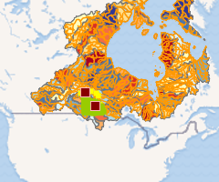
- Weather Keeper Watershed Map
- License
- Creative Commons Attribution 4.0 International (CC BY 4.0)
-
+ You are free to: Share — copy and redistribute the material in any medium or format. Adapt — remix, transform, and build upon the material for any purpose, even commercially. The licensor cannot revoke these freedoms as long as you follow the license terms.
+ For more info see https://creativecommons.org/licenses/by/4.0/. - Abstract
The Weather Keeper Program is a collaboration between the Manitoba Métis Federation and the Centre for Earth Observation Science at the University of Manitoba, to support the collection of atmospheric data in the Manitoba Great Lakes region. This program is a co-developed, and jointly managed, monitoring network that will provide information on how the Manitoba Great Lakes respond to land-use changes and variability in weather. The program will also give insight into the local and regional effects of climate change.
- Publication Date
- Aug. 5, 2022, 2:20 p.m.
- Category
- Inland Waters
- Inland water features, drainage systems and their characteristics. Examples: rivers and glaciers, salt lakes, water utilization plans, dams, currents, floods, water quality, hydrographic charts.
- Regions
- North America
- Responsible
- MMF
- Group
- Manitoba Métis Federation
- DOI
- 10.34992/0147-wx73
- Attribution
- Manitoba Métis Federation, Petrynko, Jenny, McCullough, Greg, Herbert, Claire, & Barber, David. (2021). Manitoba Métis Federation Weather Keeper Program. https://doi.org/10.34992/0147-wx73
- Restrictions
-
Users must notify the Manitoba Metis Federation of their intent to use the data and must also use the attribution or citation information when referring to the data.
- Edition
- 1.0
- Purpose
This map includes weather stations from the Weather Keeper program as well as mapping layers of interest for users interested in the project and its impact in the Manitoba Great Lakes.
- Language
- English
- Data Quality
Data level 0 (raw data). Weather station towers are not the standard height as weather towers operated by Environment and Climate Change Canada.
- Wind and gust speeds reported at St Laurent Li Taan Aen Staansyoon indicate speeds that would be felt nearby on the lake only when the wind blows from SSW through W to NNW. The anemometer is sheltered from the full force of the wind by trees in other directions.
- Wind and gust speeds reported at Dawson Bay Li Taan Aen Staansyoon indicate speeds that would be felt nearby on the lake only when the wind blows from SE. The anemometer is sheltered from the full force of the wind by trees and a building in other directions.
- Supplemental Information
The Weather Keeper Program Page can be found on the CanWIN Datahub.
- Spatial Representation Type
- vector data is used to represent geographic data
Comments (0 total)
Log in to add a comment